

The Surprisingly Simple Logic Behind the Complex US Interstate Numbering System
What the heck does I-95 mean??

As you cruise down an interstate, have you ever wondered about the seemingly arbitrary numbers on these familiar shield-shaped signs?
These digits are far from random and are part of an intricate system that tells a story of mid-20th century American ambition for law and order.
The Federal Aid Highway Act of 1956, a cornerstone of Eisenhower's domestic policy, did more than just lay down thousands of miles of asphalt. It established a nationwide numbering system that, once understood, will allow you to know exactly where you anywhere in the United States by simply looking at the interstate number.
It’s the Hitchhiker’s Guide to the US Interstate System.
The system's elegance lies in its simplicity. Major north-south routes end in 5, increasing from west to east.

I-5, hugging the Pacific coast from Mexico to Canada, gives way to I-15, I-25, and so on, culminating with I-95 tracing the Atlantic seaboard. East-west routes, conversely, are multiples of 10, ascending as they move north. The I-10 stretches along the sun-baked South from Santa Monica to Jacksonville, while I-90 traces the northern frontier from Seattle to Boston.

This numerical choreography allows a driver to pinpoint their rough location on the continent merely by glancing at nearby route markers. Lower numbers indicate you are in the Southwest, while higher numbers indicate you’re in the Northeast.
But the system's complexity doesn't end there.
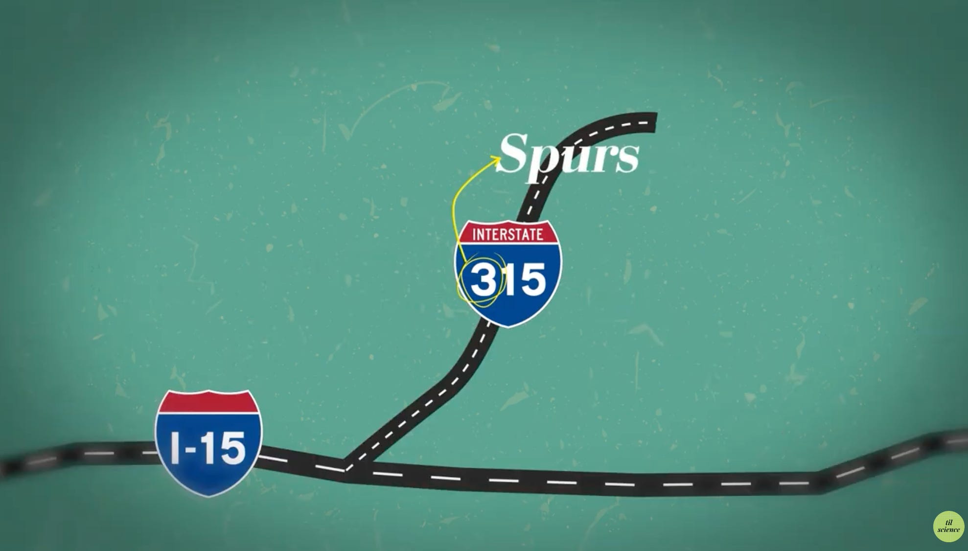
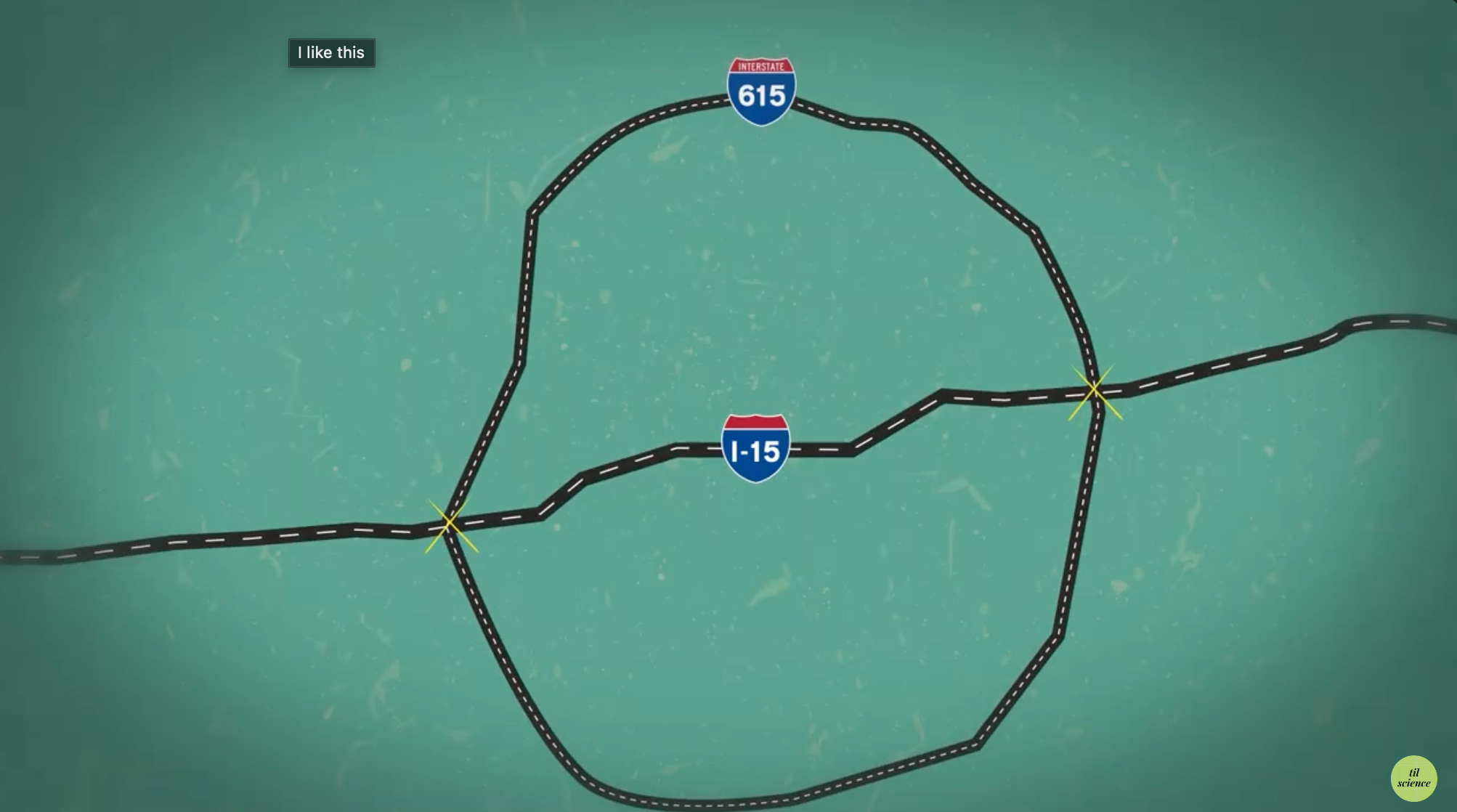
Three-digit interstates, the capillaries to the major routes' arteries, follow their own logic. The last two digits indicate the parent route, while the first digit reveals the nature of the offshoot. There are 3 types of I-minors and the first digit signifies what type of minor it is:
Spurs: Odd-numbered routes warn you that this route will not connect back to its parent route. These are called Spur routes because they connect to or intersect the parent route at one end like I-110 linking I-10 to the Port of Los Angeles, are dead ends.

Bypasses: Connect to the parent route at both ends and start with an even number, such as I-220 skirting Shreveport.

Beltways: Form a loop, like a belt, that intersects the parent route at two locations. Beltways also start with an even number but are only associated with north-south or vertical routes and thus end in 5 like Washington D.C.'s I-495 "Capital Beltway".


Even the directional suffixes tell a tale. When I-15 splits into I-15N and I-15S in San Diego, it's a promise that these wayward paths will eventually rejoin their parent route.

Yet, like America itself, the interstate system isn't without its quirks and exceptions. The iconic Route 66 and the scenic Highway 101 stand as reminders that not all roads conform to the interstate's regimented logic. These outliers, along with various state-specific oddities, serve as testament to the country's diverse and sometimes chaotic growth.

It's a reminder that even in our age of satellite navigation and real-time traffic updates, there's an older, analog system quietly guiding us—if we know how to read it.
The next time you merge onto an interstate, take a moment to appreciate the number on the sign. It's not just a label; it's a coordinate in a grand, asphalt-paved map stretching from sea to shining sea.